How this World Heritage was shaped
750 year of innovative heritage
Origins
The Alblasserwaard region originated in a time when this area and the surrounding region was a large peat bog, caught between major rivers. The first farmers settled on the higher-lying banks of glacial sand and clay deposits, called donks. This is where their struggle against the water began.
To make this wet, unpassable landscape habitable and fertile, they first dug separate ditches for drainage. Later, they joined forces to build dikes, till the peat bogs, and drain away the water via a network of ditches. Their efforts shaped the Alblasserwaard region as we know it today.
Ring of dikes
Count Floris V, a powerful local lord, ordered the inhabitants to work together to maintain the upkeep of, and reinforce, the entire ring of dikes around the region. This extremely important decision, made in the province of Zuid-Holland, laid the foundations for effective water management in this region and helped protect the land against flooding. This collaboration is one of the early examples of the Dutch tradition of controlling the water, which is still visible today at Kinderdijk and in the surrounding area.
The eternal struggle with the water
A 17-kilometer-long drainage canal, leading towards Kinderdijk and known as “Het Grote of Achterwaterschap”, was dug. This canal had a crucial part in the drainage of the land and the regulation of the water in the region and was specifically built to drain the eastern half of the Alblasserwaard. This project led to the creation of the Overwaard Water Authority.
"De Nederwaard"
The drainage canal “Het Nieuwe Waterschap” leading to Kinderdijk was dug. This canal, too, had a crucial part in the drainage of the land and the regulation of the water in the region and was specifically intended for the drainage of the western half of the Alblasserwaard. This project led to the creation of the Nederwaard Water Authority.

The first windmills
The first water-drainage mills were built in the Alblasserwaard, the region around Kinderdijk in the province of Zuid-Holland. These water-regulating mills played a crucial role in pumping away the water to drain the land and controlling the water in this low-lying region. It marked an important stage in Dutch water management that is still visible in the landscape today.
Temporary storage of water
The storage basins were dug at Kinderdijk in the province of Zuid-Holland. These pools served as temporary storage for the excess water when it was impossible to drain it away through the sluices due to the high water levels in the rivers. This clever system improved the water management and protected the local area against flooding.
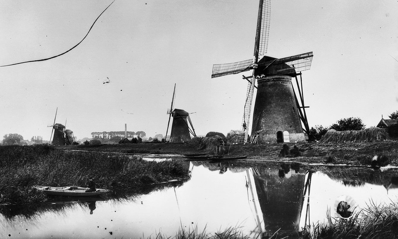
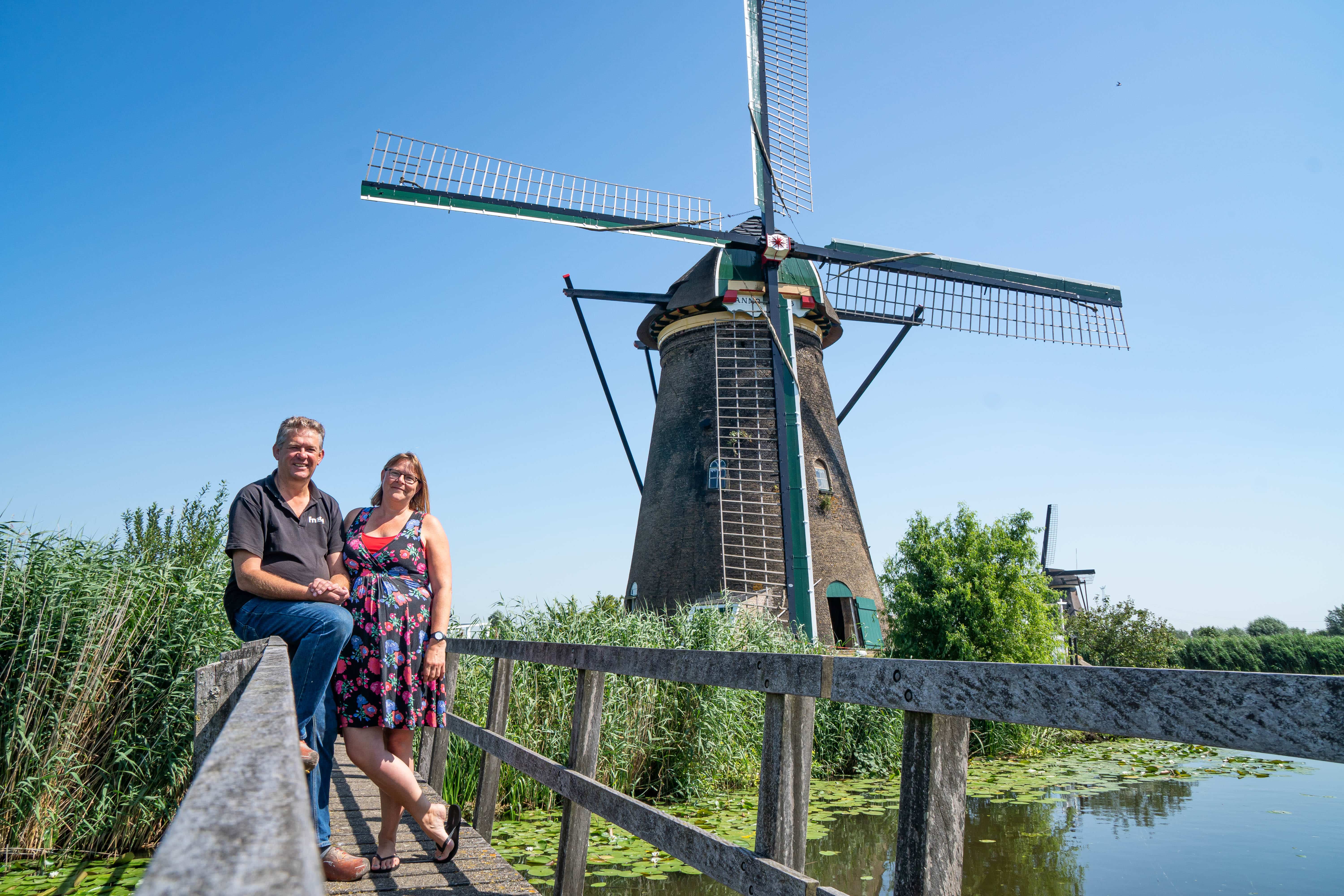
"Blokkerse Wip"
The Blokweerse Mill, also called the Blokweerse Wip, is the oldest windmill in Kinderdijk. A windmill has been on this spot for hundreds of years, as the 1542 process map reveals, but this current windmill dates from 1630. This windmill and a secondary pumping station pumped away water from Blokweer Polder until 1957, when an electric pumping station took over. After an arson attack in 1997, the windmill underwent thorough restoration, which was to preserve as much historic material saved from the fire as possible. Today, the windmill still turns and pumps regularly and it is open to the public.
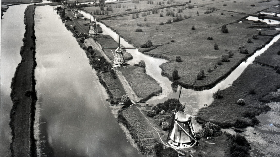
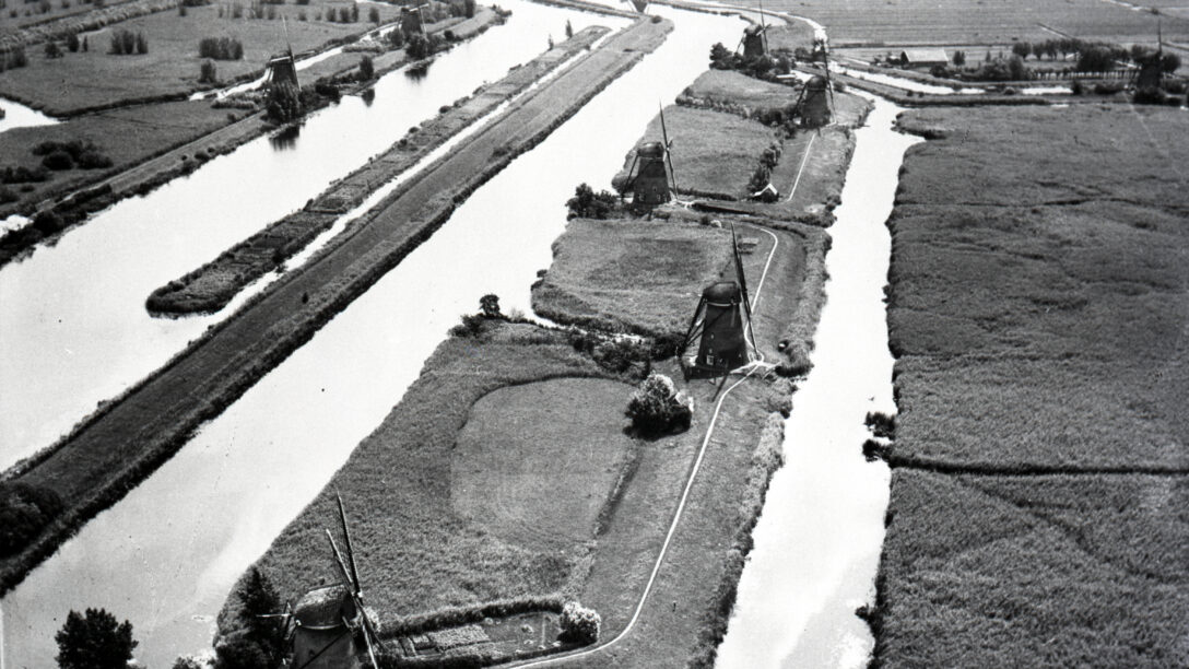
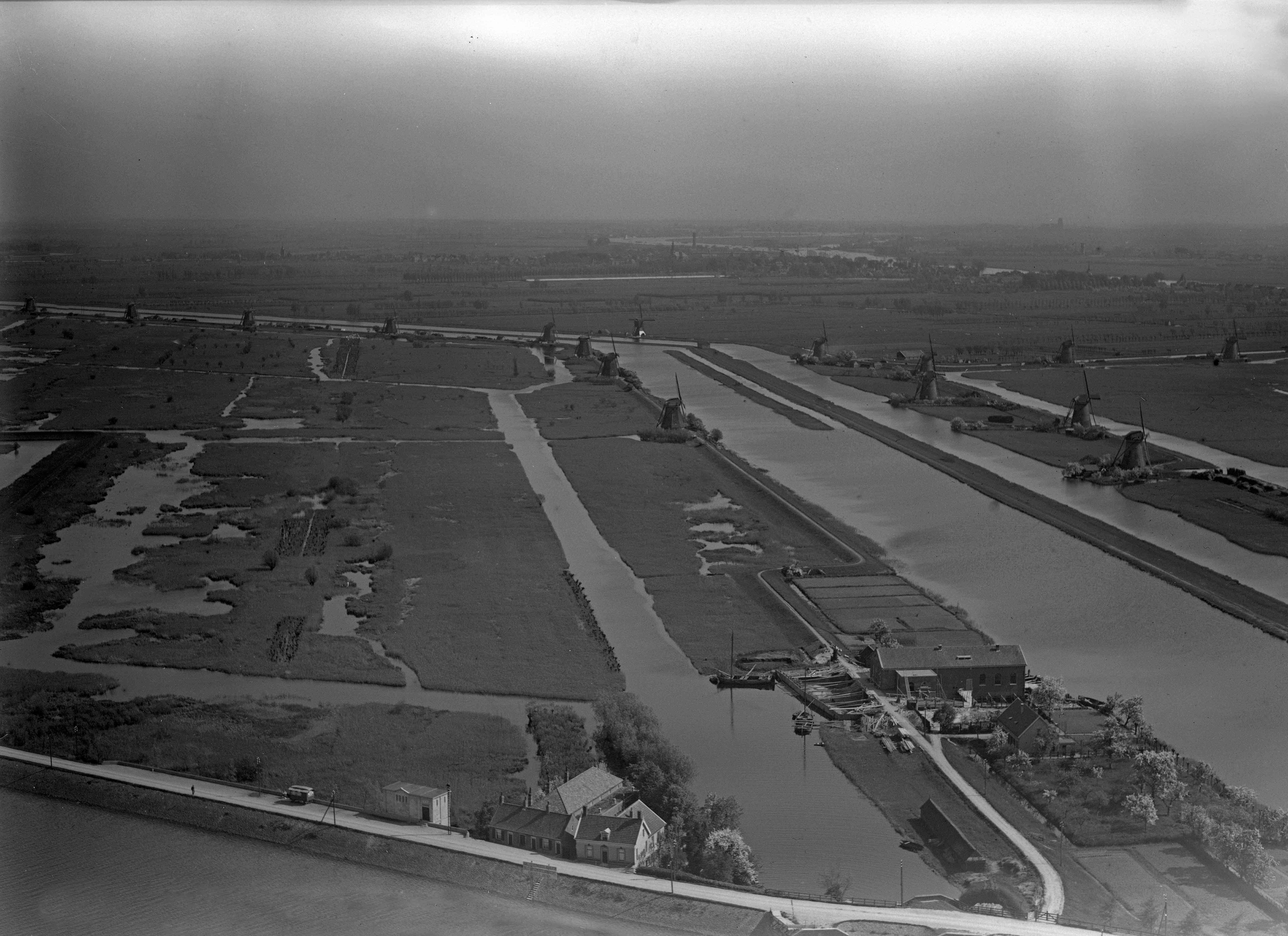
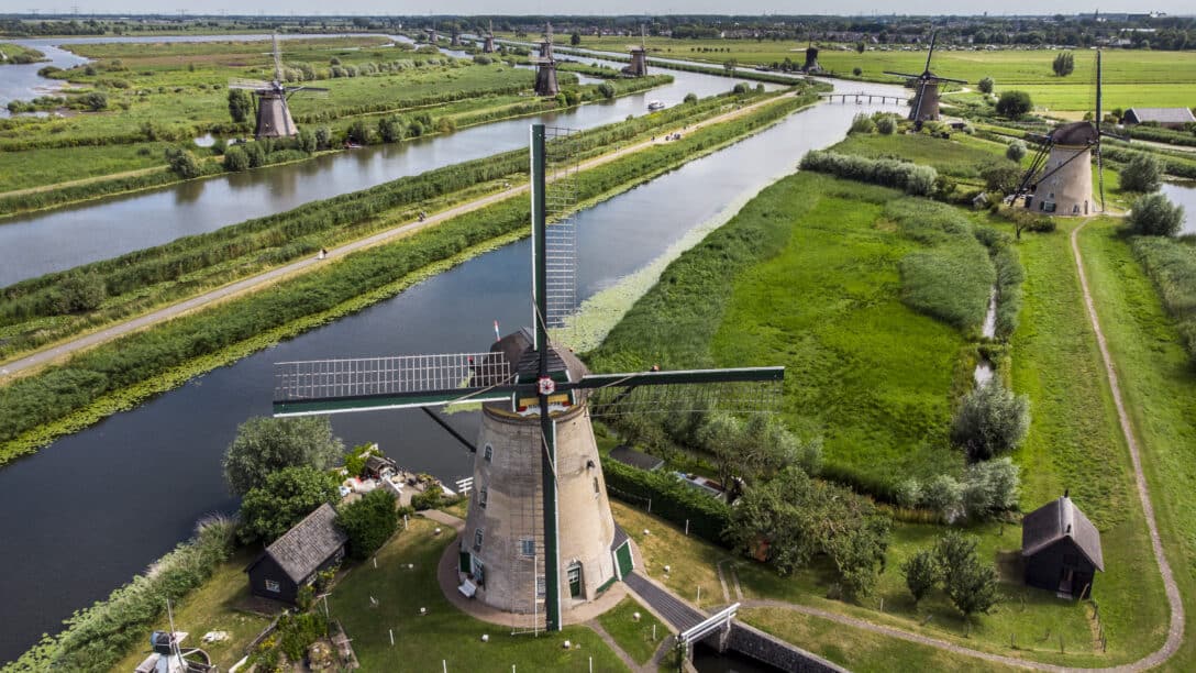
Sixteen drainage mills
As the soil started to subside and the water in the Lek River started to rise, more help was needed to keep the countryside dry. Sixteen windmills connected to storage basins were built between 1738 and 1740 to pump away all that water. Another windmill with a storage basin, the Hoge Molen (Tall Mill), was built in Nieuw-Lekkerland Polder in 1740. This polder also had two watermills. One of those two, the Lage Molen (Low Mill), was rebuilt in 1761, after its predecessor, a hollow-post mill, was heavily damaged in the preceding winter. The other bottom mill, the Oude Molen (Old Mill) from 1722, suffered a broken axle in 1945 and was never repaired; it was demolished in 1957; parts of this windmill were used in other windmills. Together with the other windmills in this area, these structures make up the current total of nineteen windmills that dictate the iconic image of Kinderdijk; they have a key role in the water management system of this World Heritage Site to this very day.

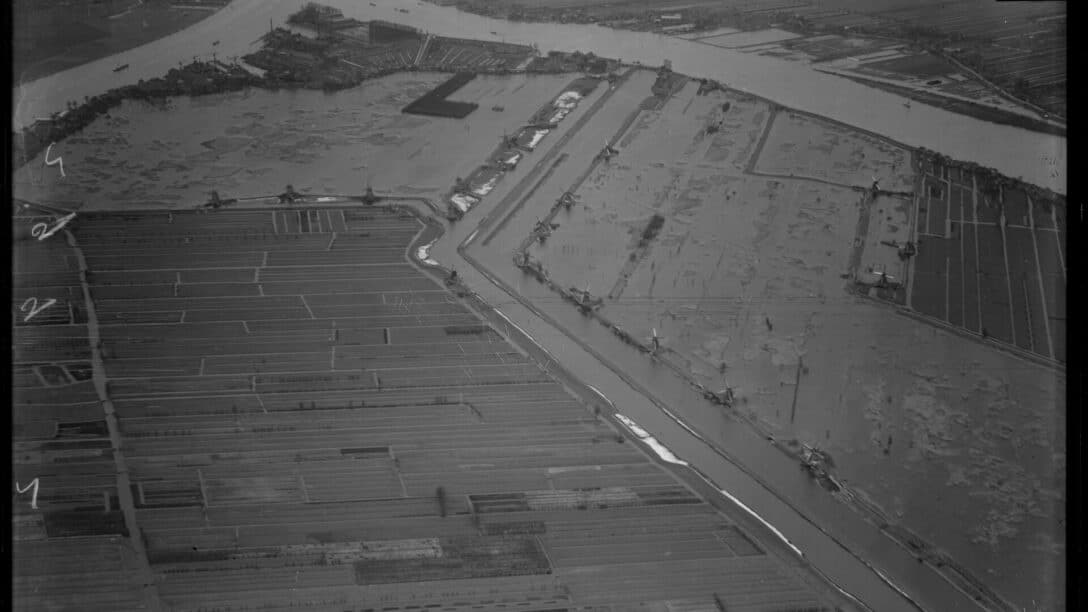
The arrival of pumping stations
Two steam-powered pumping stations were built, one for Overwaard Polder and one for Nederwaard Polder, to supplement the existing windmills. These pumping stations were more efficient at pumping away the water and reinforced the water management system in the Kinderdijk region.
Modernisation of pumping stations
Between 1924 and 1927, the steam-powered pumping stations were converted, one into an electric pumping station for Overwaard Polder and one into a diesel pumping station for Nederwaard Polder. This modernization made the water management in this area more reliable and more efficient, guaranteeing the safety and better protection of this countryside.
Are windmills obsolete?
These historic windmills still play an operative part in the history of Kinderdijk, but since the advance of modern pumping stations, their original purpose of water management has become redundant. The windmills of Nederwaard Polder were decommissioned in 1927, although they were used again temporarily during the Second World War. The windmills of Overwaard Polder remained in service until the Secondary Pumping Station was built in 1953.
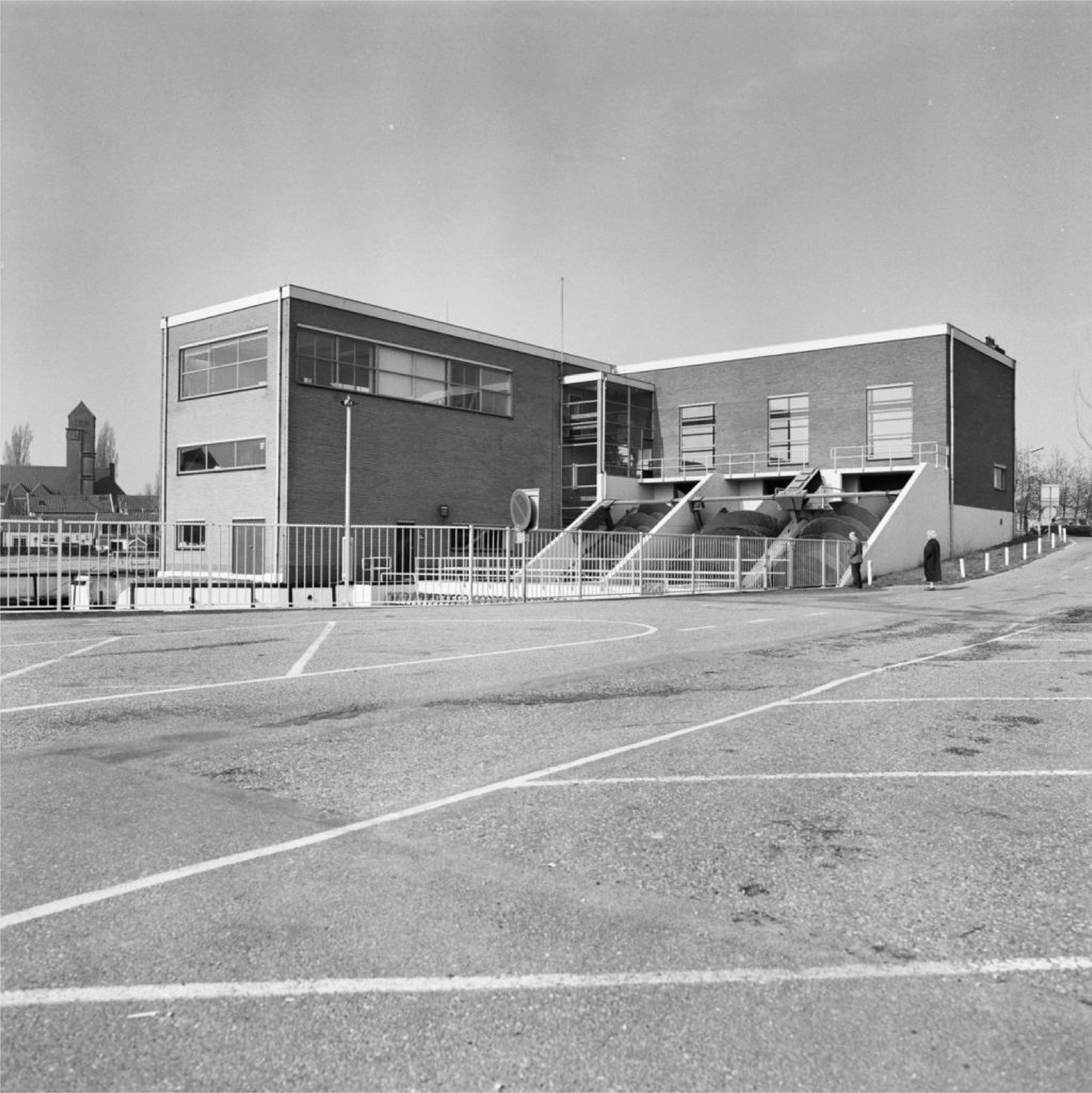
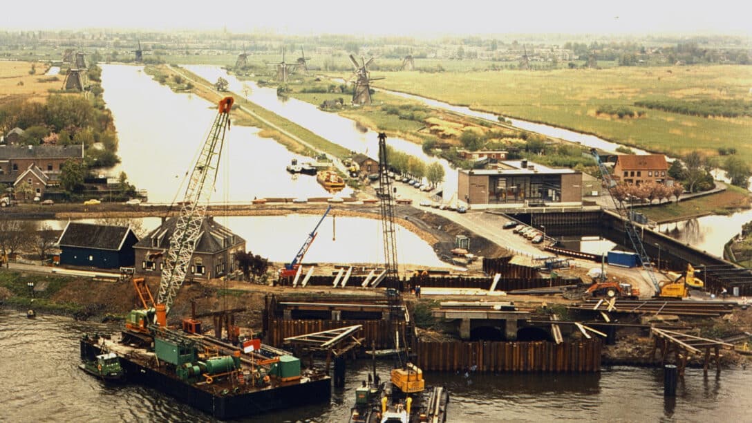
Expansion of pumping stations
In 1972, Van Haaften Pumping Station was mostly demolished; only a small piece was preserved and built into the newly constructed J.U. Smit Pumping Station, a diesel-operated pumping station with three strong engines and Archimedean screws.
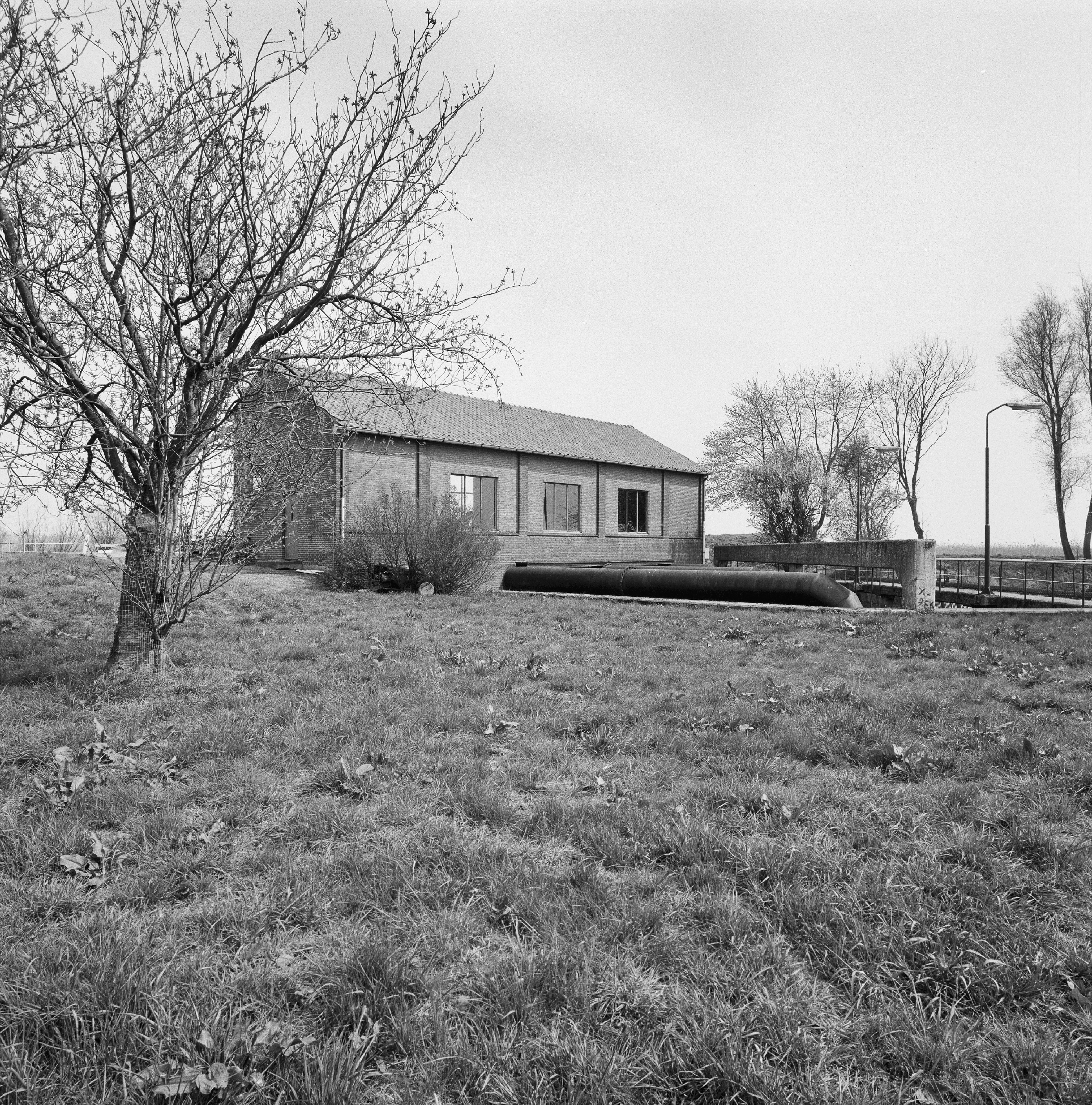
The sluice at Kinderdijk
The sluice at Kinderdijk, which is also called the Elshoutsluis, was renovated. This important water barrier plays a crucial part in the water regulation and protection of the surrounding countryside against flooding.

Pumping station
Wisboom Pumping Station was decommissioned and succeeded by the contemporary G.N. Kok Pumping Station, which is still in operation today.
UNESCO World Heritage
In 1997, Kinderdijk was officially recognized as UNESCO World Heritage. This recognition emphasizes the global importance of this unique area, where water management and landscape have been intertwined for hundreds of years.
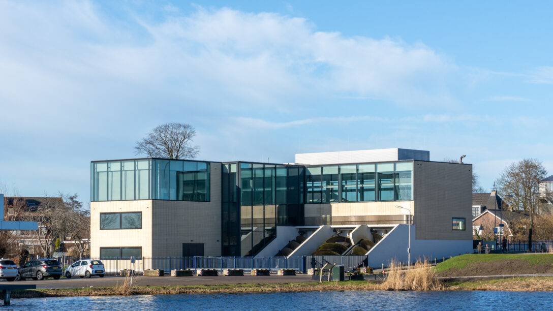
J.U. Smit pumping station
Between 2021 and 2023, two of the three screws of the modern J.U. Smit pumping station were converted from diesel to electric drive. This pumping station is still in operation.
The present day
Kinderdijk has grown to be one of the most famous tourist attractions in the Netherlands. Thanks to modern technologies and sustainable initiatives, this heritage can be cared for and presented in innovative ways. The windmills still work as backups to the water management system, but it is especially their historical and educational value that is key nowadays. In addition, many windmills are still, even now, inhabited, which means that the living nature of this World Heritage Site is preserved.